No products
World and polar maps, original antique old engraved maps. Created by renowned and skilled map and printmakers, these maps represent a treasure trove of rare and historic cartographic masterpieces.
Each antique map tells a unique story and reflects the craftsmanship and artistry of the mapmakers. These maps were meticulously engraved on copper pl...
World and polar maps, original antique old engraved maps. Created by renowned and skilled map and printmakers, these maps represent a treasure trove of rare and historic cartographic masterpieces.
Each antique map tells a unique story and reflects the craftsmanship and artistry of the mapmakers. These maps were meticulously engraved on copper plates or wooden blocks, often with intricate details, elaborate decorative elements and ornate cartouches.
The Old World in historical maps, with its rich history and diverse cultures, has been a subject of fascination for explorers, scientists and enthusiasts throughout the ages. Ancient maps of the Old World allow us to trace the paths of early explorers, understand the evolution of political boundaries, and witness the rise and fall of empires.
These maps represent the continents, countries, cities, rivers and mountains as they were understood and depicted in different eras, providing a valuable record of the past.
Each antique map tells a unique story and reflects the craftsmanship and artistry of the mapmakers.
These maps were meticulously engraved on copper plates or wooden blocks, often with intricate details, elaborate decorative elements and ornate cartouches.

Title: Orbis Vetus Le Monde Connu des Anciens.

The Story of Moses and one of the the 10 Commandments.

itel: Fecitque Deus duo luminaria magma et Stellas. Gen. I. v.i6.

From the 1789 Latin edition by Augustini Calmet.


Title: Map of the World showing the distribution of the Winds and their Influence on Navigation.


World Indicating the Colonial Possessions of the various Powers.


Intresting map of the Civilization or the inhabitants of the earth.

Title: Western Halbkugel - Östliche Halbkugel

Title: Tabula Geographica Partis Septentrionalis Maris Pacifici...

Continent Europe, old antique map with two decorative title cartouches, and a Prussian duty stamp in the higher cartouche.

Title page taken from Nouvelle atlas 1714.

Title page from atlas Atlante Novissimo... De L'Isle/ Albrizzi.
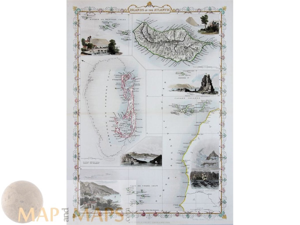
Antique map of the Islands in the Atlantic


Title : Carte reduite des Parties Septentrionales du Globe

Title: Essay D'Une Carte Reduite Contenant …1748
Title : Carte Reduite des Mers Nord... 1758.


Historiae Celebriores Title Page Weigel 1712