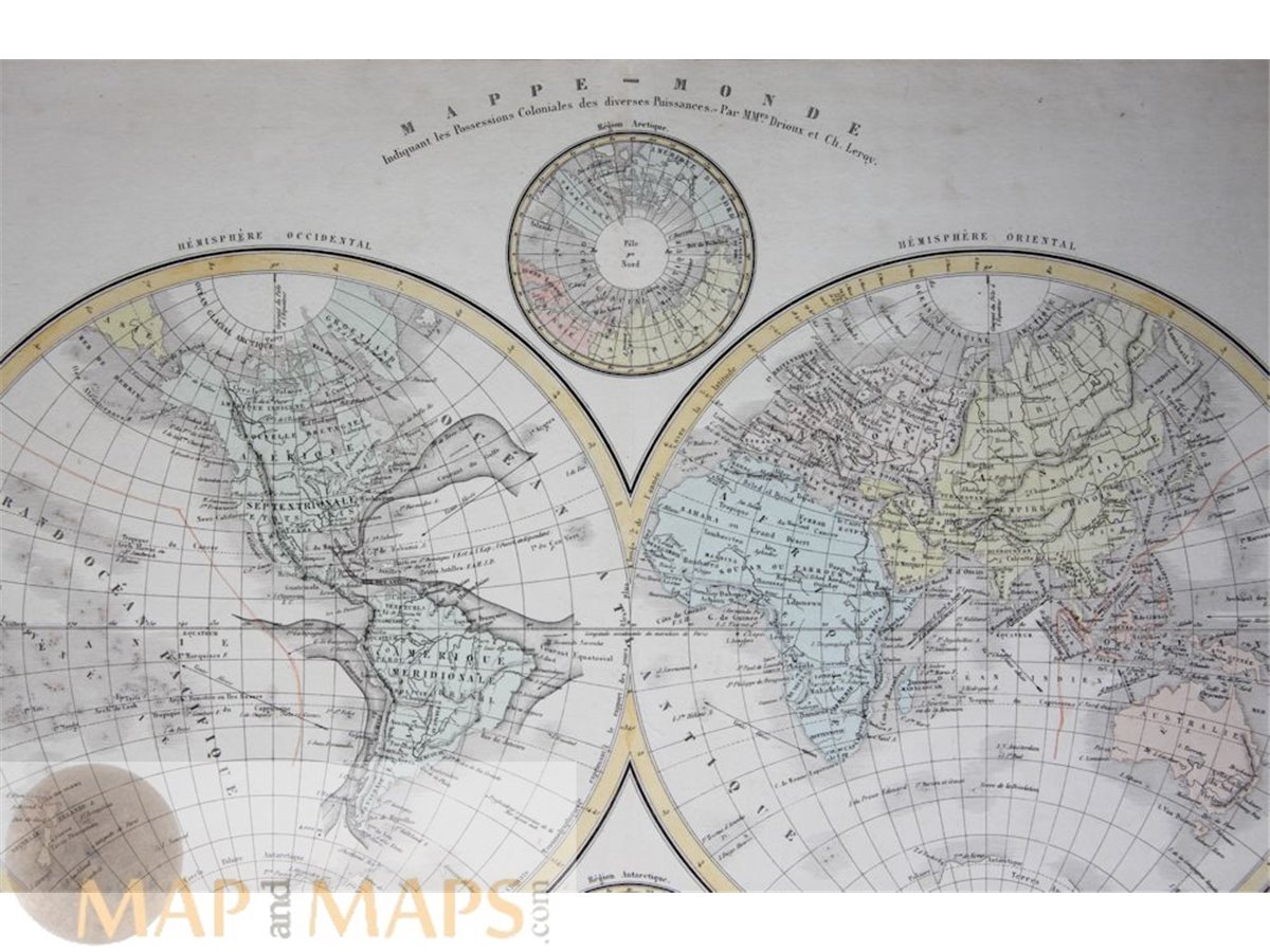
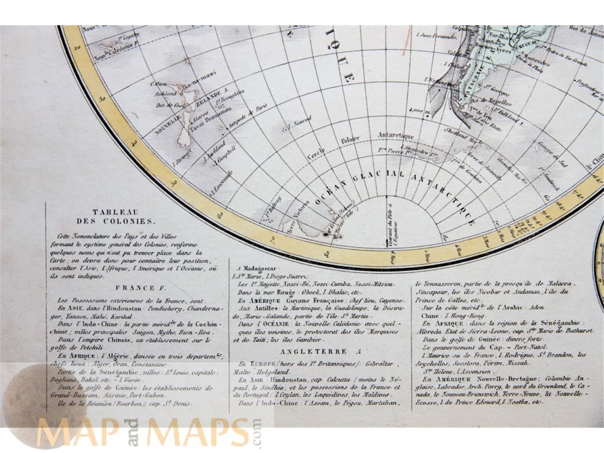
Mappe Monde Antique World Map Antarctica Drioux 1845.
Titel: Mappe – Monde Indiquant les Possesions Coloniales des diverses Puissances. Par. MMrs. Drioux et Ch. Leroy.
Description: Antique double-page World map with the North Pole and Antarctica with tables of colonies of the Europe countries. World Indicating the Colonial Possessions of the various Powers.
16th -17th -18th-19th Century maps & atlases & prints. We sell guaranteed Absolutely Original authentic Maps and Prints. A Certificate of Authenticity ( COA ) will be supplied on request. We ship internationally.
Size Sheet app.: 48 x 33 cm. 19 x 13 inches. Image: 43 x 29 cm. 17 x 11.5 inches. Condition: View very good, centre fold as published.