Stad Jerusalem Antique Maps The Holy Land Bachiene 1750
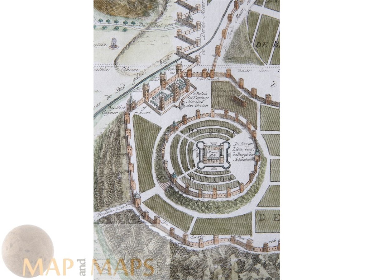
Title: Afbeeldinge der Stad Jerusalem benevens de darom heen gelegene bergen en dalen, fonteinen, waterleidingen enz.
Description: Jerusalem one of the oldest cities in the world antique town plan of the Holy town considered holy to the three major Abrahamic religions—Judaism, Christianity, and Islam. Mid 18th century map in hand coloring.
Author: Willem Albert Bachiene; Jan van Jagen
Origin: Heilige Geographie of Aardrijkskundige beschrijving van het Joodsche land.
16th -17th -18th-19th Century maps & atlases & prints. We sell guaranteed Absolutely Original authentic Maps and Prints. A Certificate of Authenticity ( COA ) will be supplied on request.
Sheet app.: 55 x 44.5 cm. 21.5 x 17.5 inches. Image app:.50 x 39 cm. 19.75 x 15.25 inches Condition: Fine engraving in very good condition. Folds as published.