Rugia Insula ac Ducatus Old map Rügen island Janssonius 1647
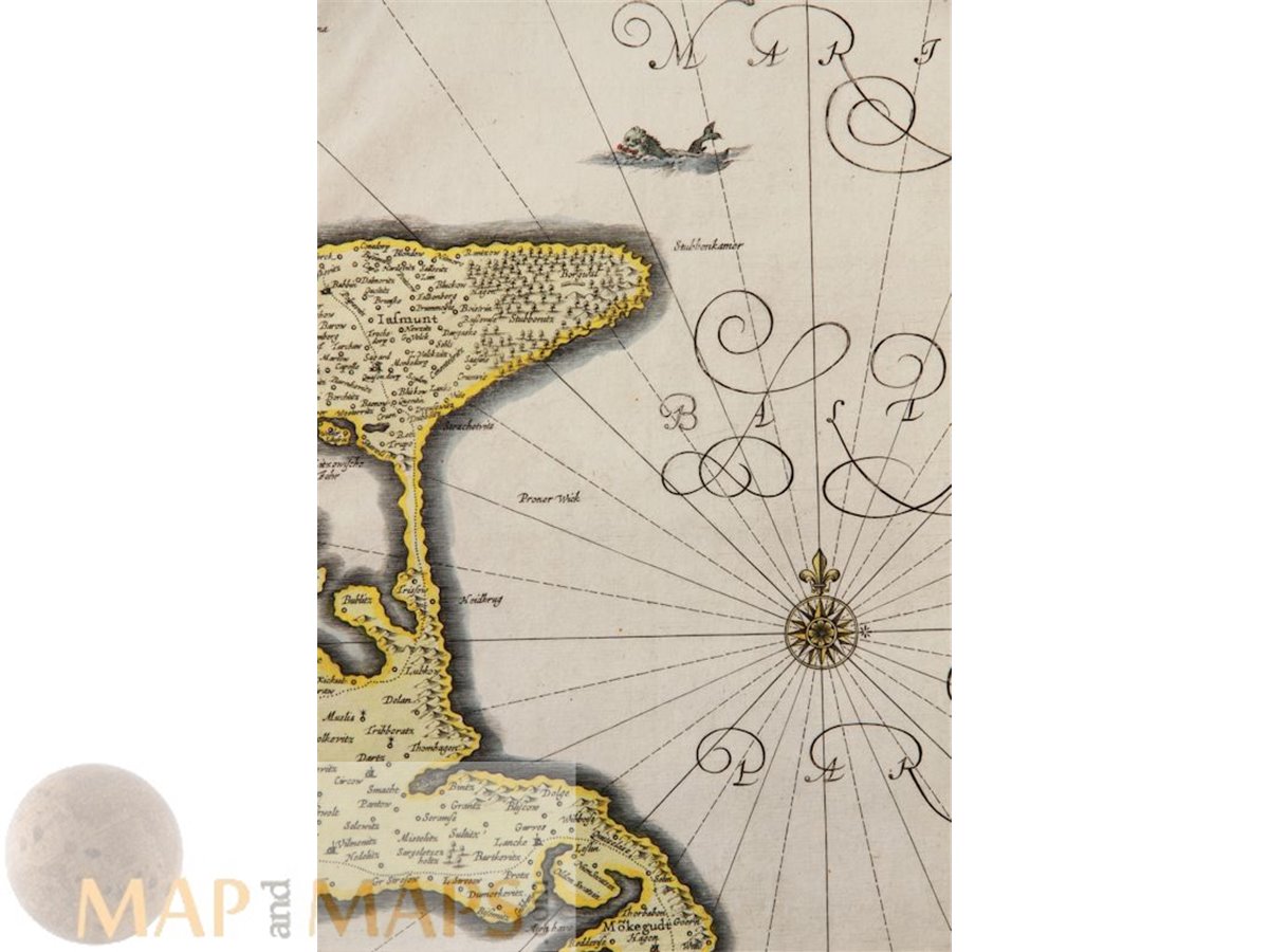
Title: Rugia Insula ac Ducatus accuratissime descripta ab E. Lubino.
Verso blanco.
Description: Rugia Island 17th century antique copper map of Rügen island, hand colored and with a nice title cartouche, compass rose and sailing vessels.
Info: Under the leadership of Janssonius the Hondius Atlas was steadily enlarged. Renamed Atlas Novus, it had three volumes in 1638, one fully dedicated to Italy. 1646 a fourth volume came out with "English County Maps", a year after a similar issue by Willem Blaeu. Janssonius' maps are similar to those of Blaeu, and he is often accused of copying from his rival, but many of his maps predate those of Blaeu and/or covered different regions. By 1660, at which point the atlas bore the appropriate name "Atlas Major", there were 11 volumes, containing the work of about a hundred credited authors and engravers. It included a description of "most of the cities of the world" (Townatlas), of the waterworld (Atlas Maritimus in 33 maps), and of the Ancient World (60 maps). The eleventh volume was the Atlas of the Heavens by Andreas Cellarius. Editions were printed in Dutch, Latin, French, and a few times in German.
Cartographer: Johannes Janssonius (1588, Arnhem – buried July 11, 1664, Amsterdam) (born Jan Janszoon, in English often incorrect Jan Jansson) was a Dutch cartographer and publisher who lived and worked in Amsterdam in the 17th century.
Authentic Antique Old Maps & Prints from the past See our historic maps of the Centuries of the World continents.
16th -17th -18th-19th Century maps & atlases & prints. We sell guaranteed Absolutely Original authentic Maps and Prints. A Certificate of Authenticity ( COA ) will be supplied on request. We ship our antique items across the world. Size: Sheet app.: 58 x 49 cm. 22.75 x 19 inches. Image app: 53 x 43 cm. 20.75 x 16.75 inches. Condition: Good map for a more than 350 year old engraving, nice hand coloring. Restoration to centerfold.(not really visible)