Germany Weissenburg Old Battle Plan map by Merian 1654
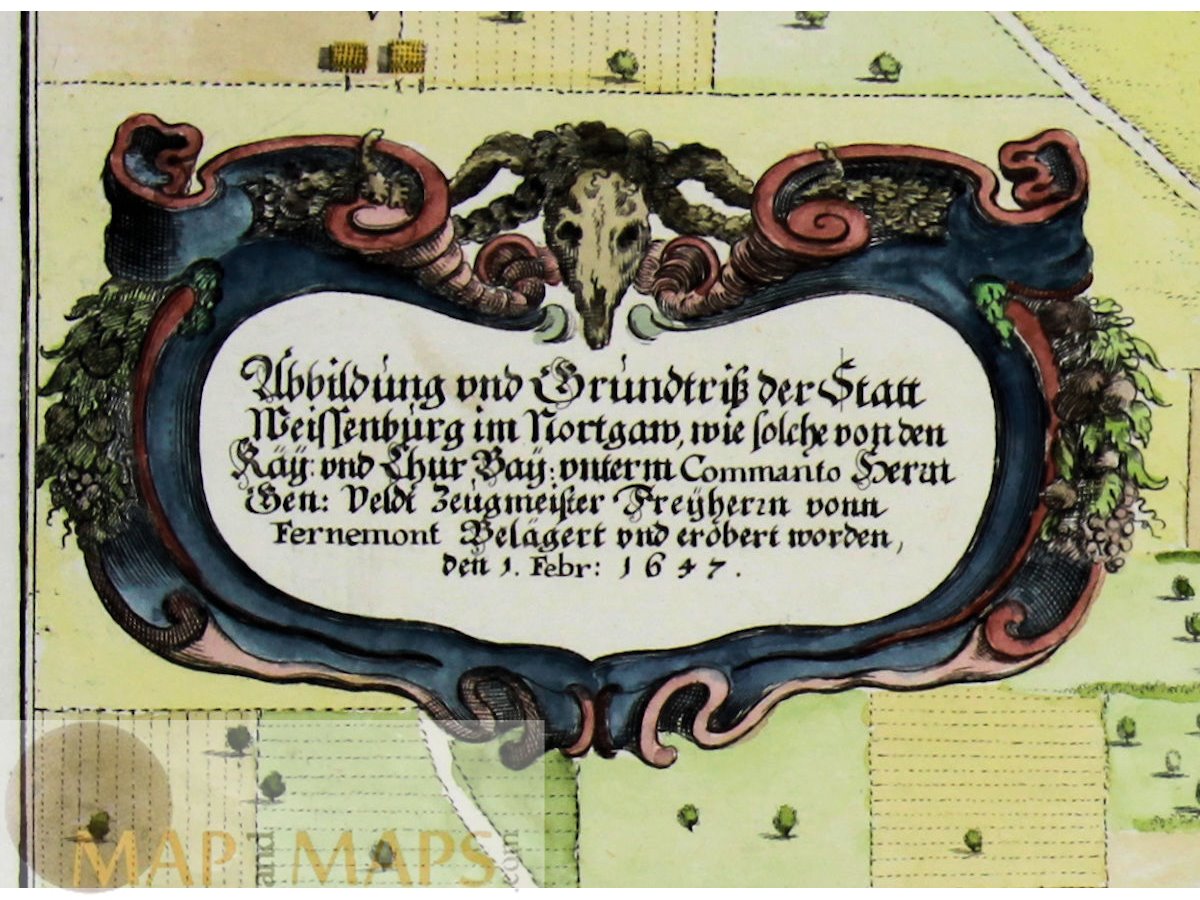
Title: Abbildung vnd Grundtriss der Statt Weissenburg im Nortgaw; wie solche von den kay: vnd chur-bay: vnterm Commanto Herrn Gen: Veldt Zeugmeister Freyherrn vonn Fernemont belägert vnd erobert worden, den 1. Febr: 1647.
Description: Antique Battle plan of the siege of Weissenburg Bayern with fortifications of the town, a decorative title cartouche and an explanation box at lower right. The map is copperplate engraved with hand coloring.
Mapmaker: Matthäus Merian a Swiss-born engraver who worked in Frankfurt Germany as geographer, and later (circa 1640) with his son, Matthäus Merian.
16th -17th -18th-19th Century maps & atlases & prints. We sell guaranteed Absolutely Original authentic Maps and Prints. A Certificate of Authenticity ( COA ) will be supplied on request.
Size: Sheet app.: 39.5 x 34 cm. 15.75 x 13.5 inches Image app.: 33 x 24 cm. 13 x 9.5 inches. Condition: View overall very good, light browned borders.