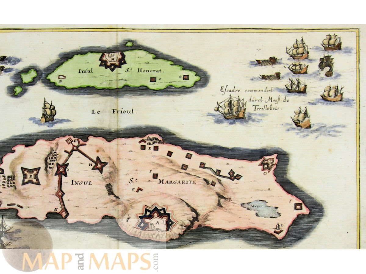
France Map St. Margarite, St. Honorat Isles, Merian 1637
Title: Eigentliche Delineation der Insulen S. Margarite und St. Honorat...
Description: France Islands, old antique map of the St. Margarite and St. Honorat Isles near Cannes. The map shows the fortifications, Spanish and France vessels during the Spanish France War. The islands were taken by the Spanish and occupied for two years.
Cartographer: Matthäus Merian der Altere (Basel, 22 September 1593 - Bad Schwalbach, 19 June 1650)
16th -17th -18th-19th Century maps & atlases & prints. We sell guaranteed Absolutely Original authentic Maps and Prints. A Certificate of Authenticity ( COA ) will be supplied on request.
Size: Sheet app.: 39.5 x 34 cm. 15.25 x 13.5 inches.. Image app:. 35.5 x 28 cm. 13.75 x 10.75 inches. Condition: Very good, fold as published.